
It has been a long time since King County stopped maintaining a bike map. Seattle releases their updated map every year, but it ends at the city limits. But folks biking on the Eastside are mostly left to cobble together route info from wherever they can find it.
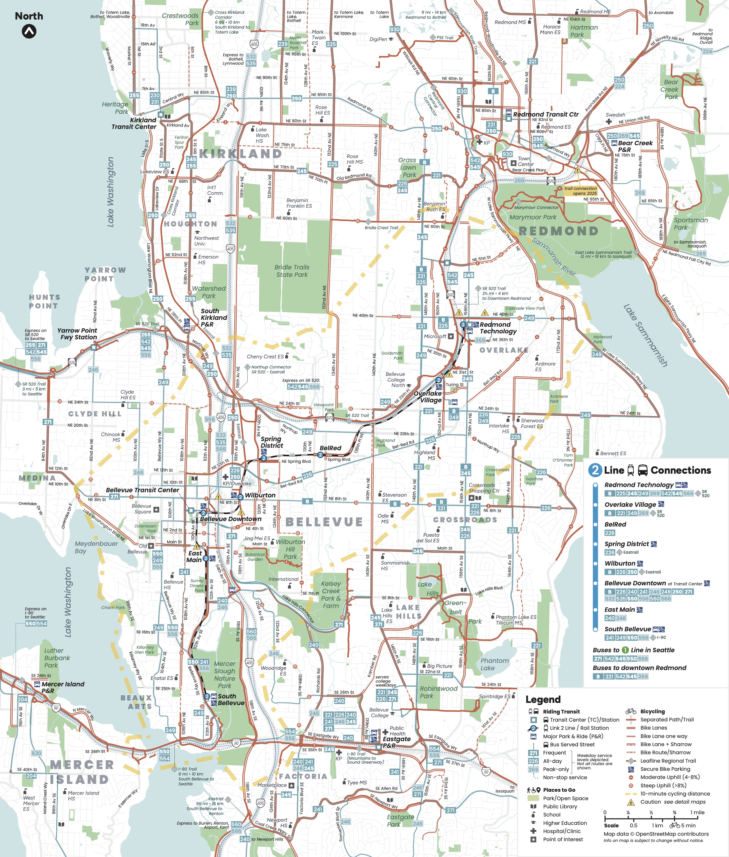
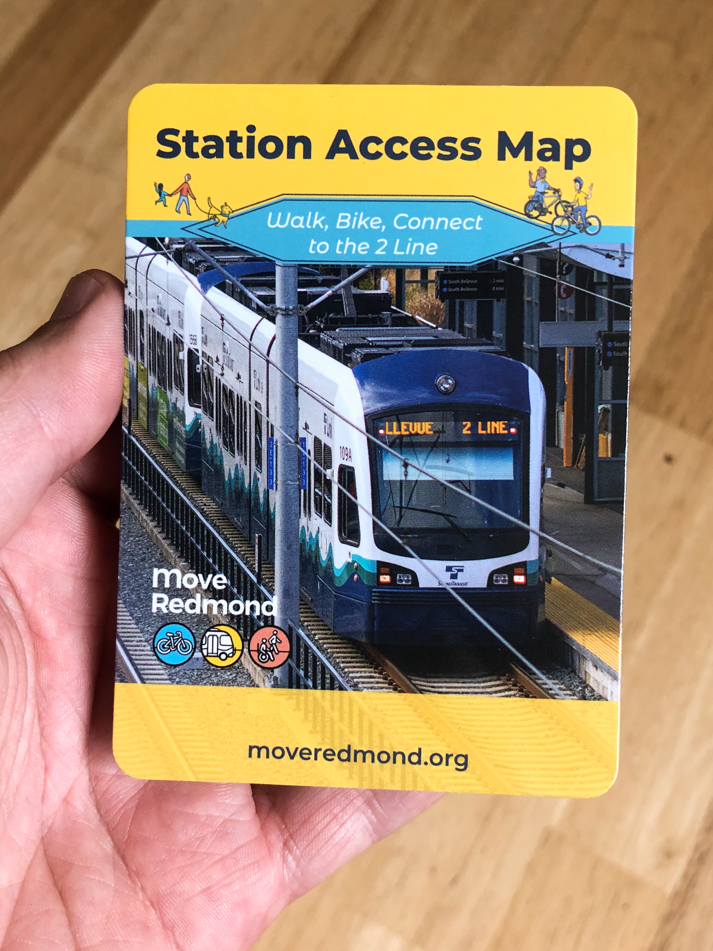
That’s why I have been very excited about Move Redmond’s new map. Full disclosure: My spouse Kelli is the Executive Director of Move Redmond, so I’ve been watching them develop their new Station Access Map for a while now. They created it as a way to help people figure out the walking, biking and transit options available to get them to and from the 2 Line light rail stations that are set to open Saturday (April 27). But in the process, they also created a unified Redmond, Kirkland and Bellevue bike map for the first time in a decade.
The design of this thing is excellent. It was crafted by Oran Viriyincy, a very talented mapmaker who previously designed the also excellent Seattle Transit Map. Oran has somehow managed to clearly communicate a lot of information without making the map appear overwhelming or confusing. You can find all the current bike routes, trails and bus lines in addition to the new light rail lines. But if you keep looking, there even more to unpack. For example, there’s a faint yellow dashed outline showing all areas within a 10 minute bike ride of a 2 Line station.
Though the utility of the 2 Line won’t be fully unlocked until it crosses Lake Washington, this is a big moment for the Eastside. Ever since suburban development began, cars have been the default way of getting around the area for a lot of residents, workers and visitors. Transit, walking and biking have been gradually becoming more and more important as Eastside communities get denser, setting up what could be a watershed moment when light rail service begins. This is a chance for people to redraw their mental maps of the Eastside based not on the locations of freeways and off-ramps but on the pathways to transit stations. This is a chance for people to invent entirely new transportation options for themselves. That bus route that used to take too long to get you where you need to go may now get you to light rail. That long and intimidating bike ride to Bellevue Transit Center may now be a shorter and easier bike ride to a 2 Line station with secure bike parking (also marked on the map). Or maybe you can just bike the whole way after all now that you can see where the bike lanes are.
When you transform your mental map of your community into an array of different transportation options, driving into the same traffic jam day after day sure seems limiting and dull. The most important maps in King County are the nearly 2.3 million maps inside residents’ heads, and the 2 Line is a major opportunity for people to redraw their own understandings of how to get around this place where they live, work and play.


Comments
6 responses to “A new Eastside bike map just dropped”
This map absolutely slaps compared to the rainbow puke nonsense put out by Bellevue, where there are more lines (maybe rightfully so) that show “caution area” routes than the actual good bike routes. It’s almost as if they want to scare you away from biking.
https://chooseyourwaybellevue.org/sites/default/files/inline-images/BellevueBikeMap_WEB-FINAL_3-18-20_shrunk.pdf
Awesome mapping. Great to see bike and transit together. The online version has lots more when zooming in. Now, dreaming, if this could be a layer in RideWithGPS…. and if Seattle could do graphics as elegantly as this.
This is fantastic. Just one thought: it seems that most of the bike maps I use have green lines to designate bike lanes, bike trails, greenways, etc. Wondering why that wasn’t done here? When doing a quick visual scan of a map it’s nice to see those long green routes that some of us are visually attuned to see. Just a thought for Oran. Great work Move Redmond!
The 10-minute bike distance outline is a master stroke.
Every time I see a map with the hill markings I wish the convention was the other way, with arrows pointing downhill instead of uphill (i.e. in the direction gravity is pulling you). But that’s not on this map, which seems pretty good.
And… of course this map, by incorporating “Leafline” designations, provides plenty of anti-Leafline fodder. Leafline logos along absolute mud puddles of trails, impractical routes, and disconnected segments. Leafline logos along good trails, stealing credit from the people that envisioned, planned, advocated, and built them. And, all over the map, gaps in bike connectivity that Leafline, despite all the power and clout its backers have, will never fight to fix. Maybe it’s fitting that we have an org like that around a city that’s become wealthy sitting atop an economy where so much profit is taken by people that do so little work in delivering the things they take credit for.
This is a really great map, thanks for posting it! At least I’ve learned that my bike rides to Crossroads mall (from and to Seattle) haven’t missed an obviously better route. It’s pretty sad that there is no good way to bike to Crossroads. 156th is very busy and fast, but maybe now there’s a decent connection to the 520 trail at 31st? So far, I’ve done 24th to 148th, which I didn’t really like.
Where this one stopped – to the north, at least – I picked up. Have release one of the Greater Northshore Connector Bike Map, linking from this through Juanita, Woodinville, Bothell, Kenmore, Lake Forest Park, and Shoreline to Seattle. North End Represent!
Currently using a github because I have one:
https://github.com/solarbirdy/NorthshoreBikeMap/
Latest map as of today, May 3rd, 8:42pm update:
https://github.com/solarbirdy/NorthshoreBikeMap/blob/main/north-king-county-base-map%20west%20RELEASE%201%20MAY%202024%208.42pm.png