
Two years in the making, the Seattle Department of Transportation completed the Beacon Hill Neighborhood Greenway this month and officially opened the route for business and bicycling.
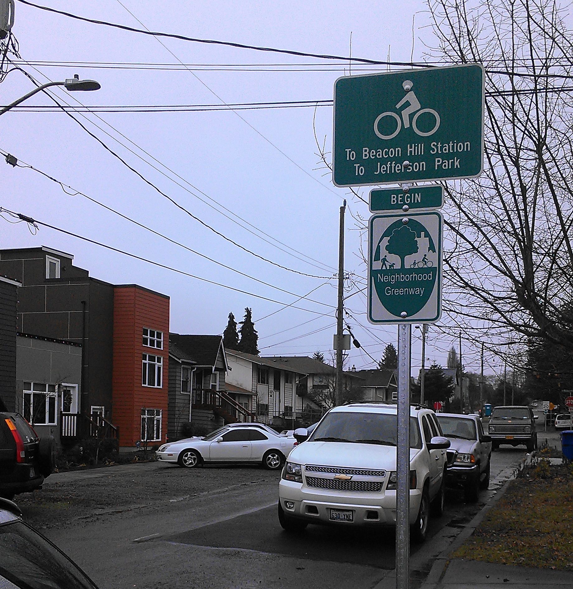
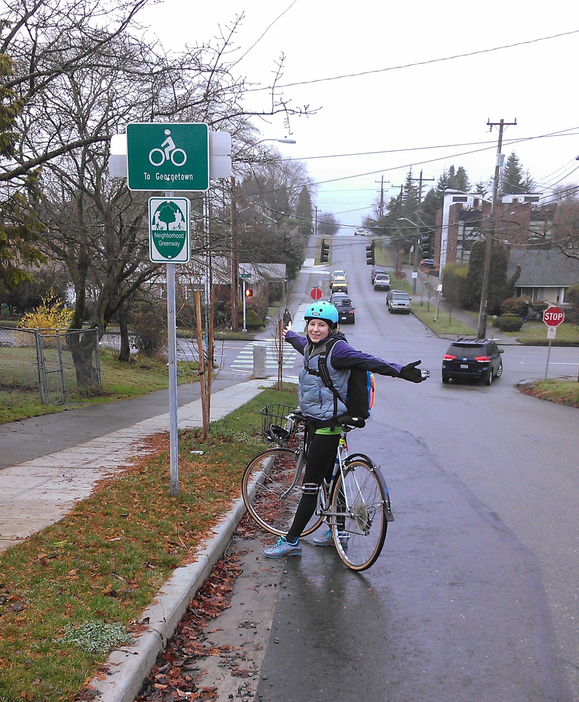
Proposed by the neighborhood group Beacon BIKES (“Better Infrastructure Keeping Everyone Safer”), the new greenway allows people of all ages and abilities to travel through Beacon Hill by bike or on foot to popular destinations, including the Beacon Hill Branch library, the Link Light Rail station and Jefferson Park. On Saturday, under the warm but grey Seattle sky, I had the chance to take the 2.8-mile route for a spin.
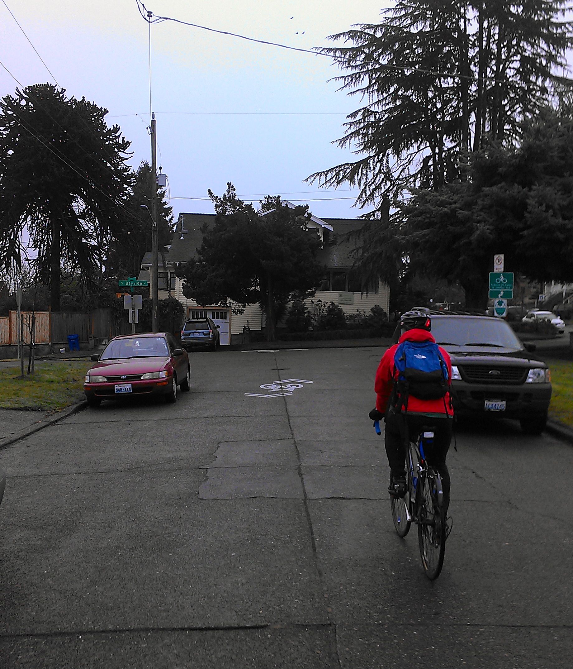
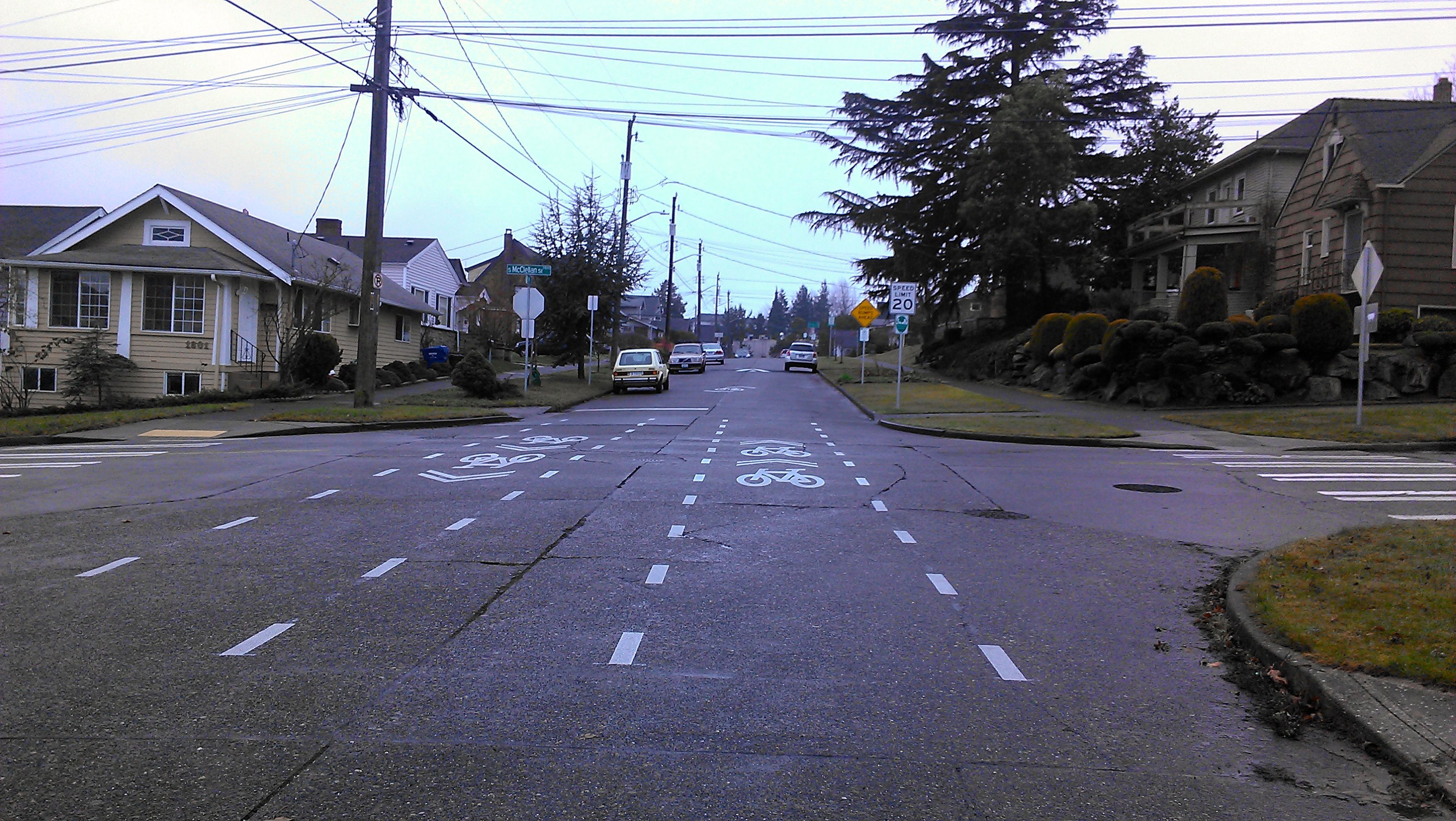
The greenway uses low-traffic neighborhood streets (primarily 18th Ave S), speed humps and 20 mph speed limits to create a comfortable route through the heart of Beacon Hill from the I-90 Trial to Georgetown. At intersections, stop signs and crossbikes improve safety and priority for people on bikes traveling through.
Busier intersections; such as S Hanford Street and Beacon Ave S, and where S Lafayette crosses S Spokane Street to connect to Jefferson Park, now have pedestrian crossing islands.
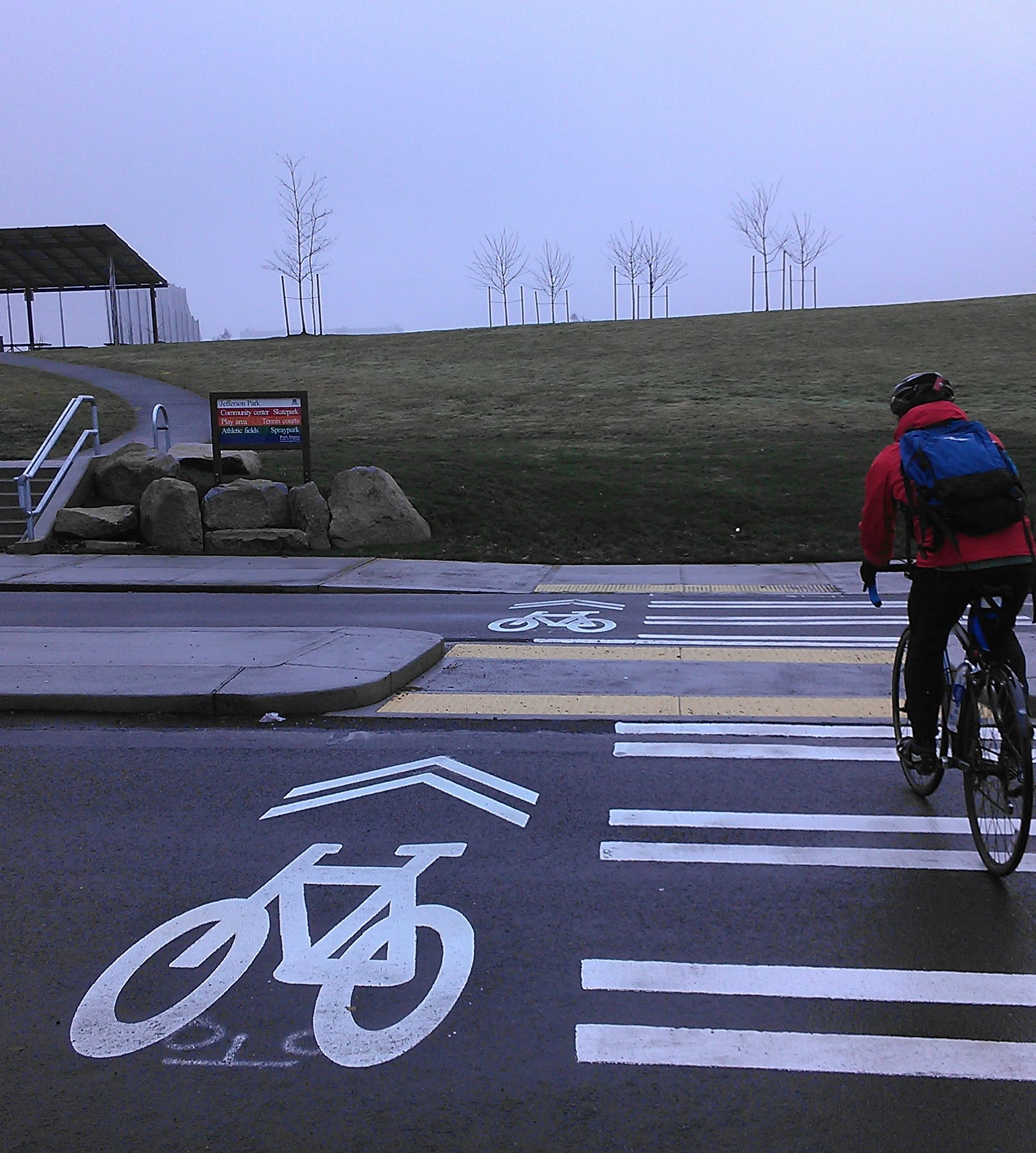
The verdict? We successfully traveled to Jefferson Park on what seemed like a private bike boulevard. After taking 15th Ave S and Beacon Ave S by bike from Capitol Hill to Ultimate Frisbee games in Jefferson Park all summer, I found this route infinitely more pleasant and surprisingly flat.
Not a Beacon Hill native, the wayfinding signs indicating key neighborhood destinations were my favorite new addition (especially how to get back to the Link station to cheat our way back into downtown on the warm and dry light rail).
The Beacon Hill Greenway continues from the southwest corner of Jefferson Park on 13th and 14th avenues to S Lucile Street. In 2014, SDOT plans to complete a paved path for walking and biking on 16th Ave S. I also hope there are plans to add wayfinding through the park to connect to the rest of the greenway.
As for the rest of Beacon Hill, the Seattle Bicycle Master Plan includes a protected bike lane on 12th Ave S from the Jose Rizal bridge into the neighborhood, and a connecting greenway facility from 13th Ave S to S Hill street to the current route. Beacon Ave S is also slated from some improvements in the plan with a protected lane through Jefferson Park and a proposed off-street facility from for the remainder of the arterial.


Comments
18 responses to “A bike tour of the now-open Beacon Hill Neighborhood Greenway”
Thank you for these updates. I really appreciate them and when I have gotten lost or confused (ie:Missing Link), I have looked back here to fine my way. I can’t wait to try this route.
I meant find my way..
Surprised that Jefferson crossing is marked as a facility cars can use. Where do cars go once they’re on the sidewalk? Or is that just another SDOT misuse of sharrows?
The map is correct, but please correct your narrative to call the numbered avenues by their correct names, i.e. 18th Avenue South (NOT S 18th St). Thanks!
Updated. Thanks.
Huh, is that a crossbike marking at a non-arterial intersection? That’s the first I’ve seen SDOT do that.
Thanks for covering this! I’d tour the greenway myself, but I’m never on Beacon Hill.
Wow, I’ve used this a couple times (I’m rarely on Beacon Hill), but I always thought it was complete…
I’m glad to see the greenway go in, but some of the construction is shoddy. The two-month-old speed hump in front of my house on 13th is shedding asphalt.
This was also my point on the 58th street Greenway. The asphalt overlay they set down is already starting to crack in places and I highly doubt it will make it through more than two or three wet Seattle winters. I took a course in road surfacing and sent pictures and samples back to a professor who noted that there were some major flaws in some of the work done by SDOT. Water is asphalts worst enemy and SDOT didn’t fill in the cracks in the concrete before putting in the overlay so you can actually see spots where water is eroding the asphalt from underneath.
However, nothing is as counterintuitive as stop signs for cross traffic at the small roundabouts. Nobody understands what to do…which has actually turned out to be a decent traffic calming measure. However, I have seen several very close calls involving pedestrians, since there are no crosswalk markings and a lot of elderly people.
so starting from the south, you are at Lucille and what is the cross street? (I live on south beacon hill)
Lucile and 12th ave s
It seems like every time you wrote a numbered street you meant avenue.
Not trying to be snarky, it just made it really confusing to read.
More generally, I’ve noticed a lot of people in Seattle have this problem of confusing St. vs. Ave. It doesn’t really seem confusing to me, Aves are north-south, Sts are east-west…
Not to mention; Avenues have their quadrant designation at the end. 39th Ave *NE*. Streets have their quadrant designation come first. *NE* 65th *St*.
Creating greenway maps is a great way to learn your local geography! :)
It’s directional rather than being for avenues and streets. Example: “NE X Way” would mean an east-west road while “X Way NE” would mean a north-south road.
Not grasping Seattle’s street naming protocol is a chronic problem for newcomers. Editors should fix such problems before posting, so the author doesn’t get embarrassed by public corrections. Not cool to depend on commenters to do an editor’s job.
[…] Beacon Hill gets its greenway. […]
Any data on how much this Beacon Hill greenway cost to construct?
[…] be possible to bike all the way from Interlaken Park to Georgetown utilizing the Central Area and Beacon Hill neighborhood greenways, which are connected by the I-90 Trail. That’s pretty cool. […]